|
NOMBRE
|
MODELO ELEVACIÓN 3D
|
|
ACATIC
|
https://iieg.gob.mx/mapas3d/14001.html
|
|
ACATLÁN DE JUÁREZ
|
https://iieg.gob.mx/mapas3d/14002.html
|
|
AHUALULCO DE MERCADO
|
https://iieg.gob.mx/mapas3d/14003.html
|
|
AMACUECA
|
https://iieg.gob.mx/mapas3d/14004.html
|
|
AMATITÁN
|
https://iieg.gob.mx/mapas3d/14005.html
|
|
AMECA
|
https://iieg.gob.mx/mapas3d/14006.html
|
|
SAN JUANITO DE ESCOBEDO
|
https://iieg.gob.mx/mapas3d/14007.html
|
|
ARANDAS
|
https://iieg.gob.mx/mapas3d/14008.html
|
|
EL ARENAL
|
https://iieg.gob.mx/mapas3d/14009.html
|
|
ATEMAJAC DE BRIZUELA
|
https://iieg.gob.mx/mapas3d/14010.html
|
|
ATENGO
|
https://iieg.gob.mx/mapas3d/14011.html
|
|
ATENGUILLO
|
https://iieg.gob.mx/mapas3d/14012.html
|
|
ATOTONILCO EL ALTO
|
https://iieg.gob.mx/mapas3d/14013.html
|
|
ATOYAC
|
https://iieg.gob.mx/mapas3d/14014.html
|
|
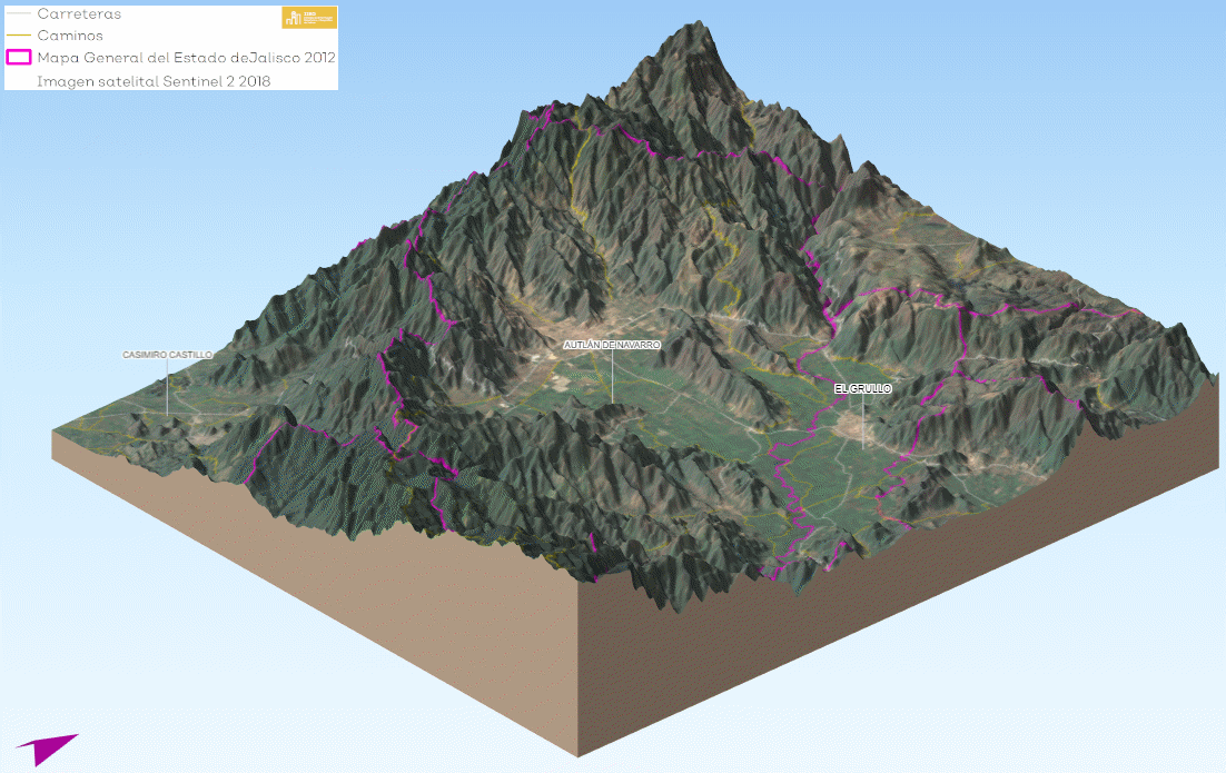
AUTLÁN DE NAVARRO
|
https://iieg.gob.mx/mapas3d/14015.html
|
|
AYOTLÁN
|
https://iieg.gob.mx/mapas3d/14016.html
|
|
AYUTLA
|
https://iieg.gob.mx/mapas3d/14017.html
|
|
LA BARCA
|
https://iieg.gob.mx/mapas3d/14018.html
|
|
BOLAÑOS
|
https://iieg.gob.mx/mapas3d/14019.html
|
|
CABO CORRIENTES
|
https://iieg.gob.mx/mapas3d/14020.html
|
|
CASIMIRO CASTILLO
|
https://iieg.gob.mx/mapas3d/14021.html
|
|
CIHUATLÁN
|
https://iieg.gob.mx/mapas3d/14022.html
|
|
ZAPOTLÁN EL GRANDE
|
https://iieg.gob.mx/mapas3d/14023.html
|
|
COCULA
|
https://iieg.gob.mx/mapas3d/14024.html
|
|
COLOTLÁN
|
https://iieg.gob.mx/mapas3d/14025.html
|
|
CONCEPCIÓN DE BUENOS AIRES
|
https://iieg.gob.mx/mapas3d/14026.html
|
|
CUAUTITLÁN DE GARCÍA BARRAGÁN
|
https://iieg.gob.mx/mapas3d/14027.html
|
|
CUAUTLA
|
https://iieg.gob.mx/mapas3d/14028.html
|
|
CUQUÍO
|
https://iieg.gob.mx/mapas3d/14029.html
|
|
CHAPALA
|
https://iieg.gob.mx/mapas3d/14030.html
|
|
CHIMALTITÁN
|
https://iieg.gob.mx/mapas3d/14031.html
|
|
CHIQUILISTLÁN
|
https://iieg.gob.mx/mapas3d/14032.html
|
|
DEGOLLADO
|
https://iieg.gob.mx/mapas3d/14033.html
|
|
EJUTLA
|
https://iieg.gob.mx/mapas3d/14034.html
|
|
ENCARNACIÓN DE DÍAZ
|
https://iieg.gob.mx/mapas3d/14035.html
|
|
ETZATLÁN
|
https://iieg.gob.mx/mapas3d/14036.html
|
|
EL GRULLO
|
https://iieg.gob.mx/mapas3d/14037.html
|
|
GUACHINANGO
|
https://iieg.gob.mx/mapas3d/14038.html
|
|
GUADALAJARA
|
https://iieg.gob.mx/mapas3d/14039.html
|
|
HOSTOTIPAQUILLO
|
https://iieg.gob.mx/mapas3d/14040.html
|
|
HUEJÚCAR
|
https://iieg.gob.mx/mapas3d/14041.html
|
|
HUEJUQUILLA EL ALTO
|
https://iieg.gob.mx/mapas3d/14042.html
|
|
LA HUERTA
|
https://iieg.gob.mx/mapas3d/14043.html
|
|
IXTLAHUACÁN DE LOS MEMBRILLOS
|
https://iieg.gob.mx/mapas3d/14044.html
|
|
IXTLAHUACÁN DEL RÍO
|
https://iieg.gob.mx/mapas3d/14045.html
|
|
JALOSTOTITLÁN
|
https://iieg.gob.mx/mapas3d/14046.html
|
|
JAMAY
|
https://iieg.gob.mx/mapas3d/14047.html
|
|
JESÚS MARÍA
|
https://iieg.gob.mx/mapas3d/14048.html
|
|
JILOTLÁN DE LOS DOLORES
|
https://iieg.gob.mx/mapas3d/14049.html
|
|
JOCOTEPEC
|
https://iieg.gob.mx/mapas3d/14050.html
|
|
JUANACATLÁN
|
https://iieg.gob.mx/mapas3d/14051.html
|
|
JUCHITLÁN
|
https://iieg.gob.mx/mapas3d/14052.html
|
|
LAGOS DE MORENO
|
https://iieg.gob.mx/mapas3d/14053.html
|
|
EL LIMÓN
|
https://iieg.gob.mx/mapas3d/14054.html
|
|
MAGDALENA
|
https://iieg.gob.mx/mapas3d/14055.html
|
|
SANTA MARÍA DEL ORO
|
https://iieg.gob.mx/mapas3d/14056.html
|
|
LA MANZANILLA DE LA PAZ
|
https://iieg.gob.mx/mapas3d/14057.html
|
|
MASCOTA
|
https://iieg.gob.mx/mapas3d/14058.html
|
|
MAZAMITLA
|
https://iieg.gob.mx/mapas3d/14059.html
|
|
MEXTICACÁN
|
https://iieg.gob.mx/mapas3d/14060.html
|
|
MEZQUITIC
|
https://iieg.gob.mx/mapas3d/14061.html
|
|
MIXTLÁN
|
https://iieg.gob.mx/mapas3d/14062.html
|
|
OCOTLÁN
|
https://iieg.gob.mx/mapas3d/14063.html
|
|
OJUELOS DE JALISCO
|
https://iieg.gob.mx/mapas3d/14064.html
|
|
PIHUAMO
|
https://iieg.gob.mx/mapas3d/14065.html
|
|
PONCITLÁN
|
https://iieg.gob.mx/mapas3d/14066.html
|
|
PUERTO VALLARTA
|
https://iieg.gob.mx/mapas3d/14067.html
|
|
VILLA PURIFICACIÓN
|
https://iieg.gob.mx/mapas3d/14068.html
|
|
QUITUPAN
|
https://iieg.gob.mx/mapas3d/14069.html
|
|
EL SALTO
|
https://iieg.gob.mx/mapas3d/14070.html
|
|
SAN CRISTÓBAL DE LA BARRANCA
|
https://iieg.gob.mx/mapas3d/14071.html
|
|
SAN DIEGO DE ALEJANDRÍA
|
https://iieg.gob.mx/mapas3d/14072.html
|
|
SAN JUAN DE LOS LAGOS
|
https://iieg.gob.mx/mapas3d/14073.html
|
|
SAN JULIÁN
|
https://iieg.gob.mx/mapas3d/14074.html
|
|
SAN MARCOS
|
https://iieg.gob.mx/mapas3d/14075.html
|
|
SAN MARTÍN DE BOLAÑOS
|
https://iieg.gob.mx/mapas3d/14076.html
|
|
SAN MARTÍN HIDALGO
|
https://iieg.gob.mx/mapas3d/14077.html
|
|
SAN MIGUEL EL ALTO
|
https://iieg.gob.mx/mapas3d/14078.html
|
|
GÓMEZ FARÍAS
|
https://iieg.gob.mx/mapas3d/14079.html
|
|
SAN SEBASTIÁN DEL OESTE
|
https://iieg.gob.mx/mapas3d/14080.html
|
|
SANTA MARÍA DE LOS ÁNGELES
|
https://iieg.gob.mx/mapas3d/14081.html
|
|
SAYULA
|
https://iieg.gob.mx/mapas3d/14082.html
|
|
TALA
|
https://iieg.gob.mx/mapas3d/14083.html
|
|
TALPA DE ALLENDE
|
https://iieg.gob.mx/mapas3d/14084.html
|
|
TAMAZULA DE GORDIANO
|
https://iieg.gob.mx/mapas3d/14085.html
|
|
TAPALPA
|
https://iieg.gob.mx/mapas3d/14086.html
|
|
TECALITLÁN
|
https://iieg.gob.mx/mapas3d/14087.html
|
|
TECOLOTLÁN
|
https://iieg.gob.mx/mapas3d/14088.html
|
|
TECHALUTA DE MONTENEGRO
|
https://iieg.gob.mx/mapas3d/14089.html
|
|
TENAMAXTLÁN
|
https://iieg.gob.mx/mapas3d/14090.html
|
|
TEOCALTICHE
|
https://iieg.gob.mx/mapas3d/14091.html
|
|
TEOCUITATLÁN DE CORONA
|
https://iieg.gob.mx/mapas3d/14092.html
|
|
TEPATITLÁN DE MORELOS
|
https://iieg.gob.mx/mapas3d/14093.html
|
|
TEQUILA
|
https://iieg.gob.mx/mapas3d/14094.html
|
|
TEUCHITLÁN
|
https://iieg.gob.mx/mapas3d/14095.html
|
|
TIZAPÁN EL ALTO
|
https://iieg.gob.mx/mapas3d/14096.html
|
|
TLAJOMULCO DE ZÚÑIGA
|
https://iieg.gob.mx/mapas3d/14097.html
|
|
SAN PEDRO TLAQUEPAQUE
|
https://iieg.gob.mx/mapas3d/14098.html
|
|
TOLIMÁN
|
https://iieg.gob.mx/mapas3d/14099.html
|
|
TOMATLÁN
|
https://iieg.gob.mx/mapas3d/14100.html
|
|
TONALÁ
|
https://iieg.gob.mx/mapas3d/14101.html
|
|
TONAYA
|
https://iieg.gob.mx/mapas3d/14102.html
|
|
TONILA
|
https://iieg.gob.mx/mapas3d/14103.html
|
|
TOTATICHE
|
https://iieg.gob.mx/mapas3d/14104.html
|
|
TOTOTLÁN
|
https://iieg.gob.mx/mapas3d/14105.html
|
|
TUXCACUESCO
|
https://iieg.gob.mx/mapas3d/14106.html
|
|
TUXCUECA
|
https://iieg.gob.mx/mapas3d/14107.html
|
|
TUXPAN
|
https://iieg.gob.mx/mapas3d/14108.html
|
|
UNIÓN DE SAN ANTONIO
|
https://iieg.gob.mx/mapas3d/14109.html
|
|
UNIÓN DE TULA
|
https://iieg.gob.mx/mapas3d/14110.html
|
|
VALLE DE GUADALUPE
|
https://iieg.gob.mx/mapas3d/14111.html
|
|
VALLE DE JUÁREZ
|
https://iieg.gob.mx/mapas3d/14112.html
|
|
SAN GABRIEL
|
https://iieg.gob.mx/mapas3d/14113.html
|
|
VILLA CORONA
|
https://iieg.gob.mx/mapas3d/14114.html
|
|
VILLA GUERRERO
|
https://iieg.gob.mx/mapas3d/14115.html
|
|
VILLA HIDALGO
|
https://iieg.gob.mx/mapas3d/14116.html
|
|
CAÑADAS DE OBREGÓN
|
https://iieg.gob.mx/mapas3d/14117.html
|
|
YAHUALICA DE GONZÁLEZ GALLO
|
https://iieg.gob.mx/mapas3d/14118.html
|
|
ZACOALCO DE TORRES
|
https://iieg.gob.mx/mapas3d/14119.html
|
|
ZAPOPAN
|
https://iieg.gob.mx/mapas3d/14120.html
|
|
ZAPOTILTIC
|
https://iieg.gob.mx/mapas3d/14121.html
|
|
ZAPOTITLÁN DE VADILLO
|
https://iieg.gob.mx/mapas3d/14122.html
|
|
ZAPOTLÁN DEL REY
|
https://iieg.gob.mx/mapas3d/14123.html
|
|
ZAPOTLANEJO
|
https://iieg.gob.mx/mapas3d/14124.html
|
|
SAN IGNACIO CERRO GORDO
|
https://iieg.gob.mx/mapas3d/14125.html
|